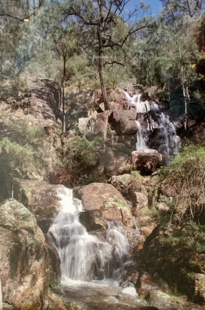
Wombeyan Falls
 |
Wombeyan FallsWombeyan Falls is a stunning two leaps waterfall located at Wombeyan Caves.
|
|||||||||||||||
 Rating: ⭐⭐ |
||||||||||||||||
Walking and driving instructions
|
Wombeyan Falls is roughly a 3hrs' drive away from Sydney CBD, or 1hrs 15minutes' from Goulburn. From Goulburn travel north on Taralga Rd for 53km. Then slide right onto Wombeyan Caves Rd and follow it until you reach Wombeyan Caves (22.2km). Roughly 15km of Wombeyan Caves Rd is an un-sealed road, the last 5km is a sealed winding road. If you drive from Sydney, the road is not suitable for caravans. There is a dedicated car park at Wombeyan Caves, which has track's sign/map, paid walks through the caves, picnic tables, campsite, cafe, information centre and toilets. From the cafe/information centre follow Waterfall Walk, which runs through Camerons Flat then along the Wombeyan Creek. As soon as you reach the creek, if there is no water then the falls will be completely dry. You will reach the falls after 1hr of walking. Return either via the same route, or via Quarry Track. Total walking time is about 2hrs. Wombeyan Falls might dry out completely. Best time to visit it after decent rain. Note: all photos are taken from the Information Centre. |
|
Waterfalls nearby
Photo Gallery
|
|


